Home > Animals > Farm > Horses > Related Images
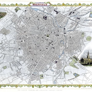
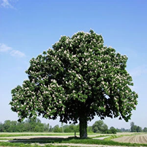
Farmhouse at Dore for sale by auction, 1858

![]()
Wall Art and Photo Gifts from Sheffield City Archives
Farmhouse at Dore for sale by auction, 1858
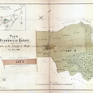
Lot 24... with the barn, stables cowhouses, sheds, yards and outbuildings, and a croft surrounded with an ornamental plantation, and the several closes of land lying continuously together towards the south, and extending from the village of Dore to the Abbey Dale [Abbeydale] Turnpike road, near Totley Bridge, comprising, Homestead, Madge or back Croft, Common, Near Flatt Head and New Wall, Far Flatt Head, far Flat, Near Flat, part Milking place, upper Hit Wood and standing stone, Nether Hut Wood, Birch Close and Little Meadow, Nether Field, Horse pasture and standing stone, Floated Field, our Acre Meadow.Lot 24A also a close of land, in the village of Dore, called Catty Croft, and lying on the North side of the church there.Lot 25 two closes of land, formerly an allotment, lying between Dore Moor Turnpike road and Long line or Standhills Lane, leading towards Ringing Low [Ringinglow].Surveyor: T. D. Jeffcock, Sheffield.Scale 3 chains : 1 inch.Original at Sheffield Local Studies Library: Sale Plans 5 August 1858
Sheffield City Archives and Local Studies Library has an unrivalled collection of images of Sheffield, England
Media ID 14050816
© Sheffield City Council
FEATURES IN THESE COLLECTIONS
> Animals
> Farm
> Horses
> Related Images
> Animals
> Mammals
> Horse
> Related Images
> Maps and Charts
> Related Images
> Sheffield City Archives
> Maps and Plans
EDITORS COMMENTS
Step back in time with this print of the Farmhouse at Dore, available for auction in 1858. This remarkable image showcases not only the charming farmhouse itself but also its accompanying barn, stables, cowhouses, sheds, yards, and outbuildings. Nestled within a picturesque croft surrounded by an enchanting ornamental plantation, this property offers a truly idyllic setting. Situated towards the south and stretching from the village of Dore to Abbeydale Turnpike road near Totley Bridge, this expansive estate comprises several closes of land seamlessly connected together. From the Homestead to Madge or back Croft, Common to Near Flatt Head and New Wall, Far Flatt Head to Near Flat - each parcel holds its own unique charm. Lot 24A adds another dimension to this already impressive offering with Catty Croft located on the north side of Dore's church. Lot 25 presents two additional closes of land that were once allotments between Dore Moor Turnpike road and Long line or Standhills Lane leading towards Ringing Low. Expertly surveyed by T. D. Jeffcock from Sheffield City Archives using a scale ratio of 3 chains : 1 inch; this print allows you to explore every intricate detail of these historic properties. Transport yourself back in time as you admire the beauty and potential held within these lands – a true testament to Sheffield's rich heritage.
MADE IN THE USA
Safe Shipping with 30 Day Money Back Guarantee
FREE PERSONALISATION*
We are proud to offer a range of customisation features including Personalised Captions, Color Filters and Picture Zoom Tools
SECURE PAYMENTS
We happily accept a wide range of payment options so you can pay for the things you need in the way that is most convenient for you
* Options may vary by product and licensing agreement. Zoomed Pictures can be adjusted in the Cart.
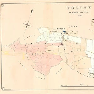

![Map of Woodthorpe Hall Farm [Holmesfield] in the parish of Dronfield, County of Derby, 1736](/sq/716/map-woodthorpe-hall-farm-holmesfield-parish-18987347.jpg.webp)