Home > Maps and Charts > Related Images
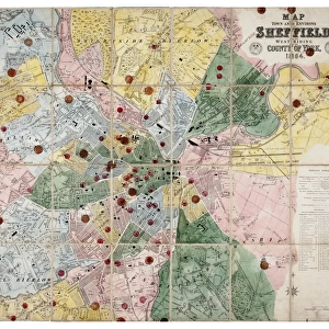
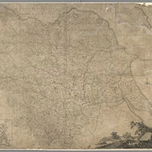
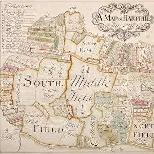
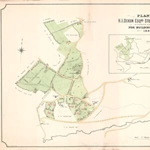
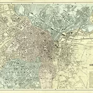
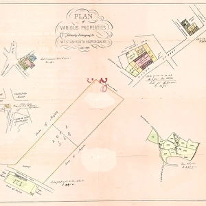
Map of Aston cum Aughton, late 18th century

![]()
Wall Art and Photo Gifts from Sheffield City Archives
Map of Aston cum Aughton, late 18th century
Sheffield City Archives reference: MD3516
Sheffield City Archives and Local Studies Library has an unrivalled collection of images of Sheffield, England
Media ID 14045912
© Sheffield City Council
FEATURES IN THESE COLLECTIONS
> Maps and Charts
> Related Images
> Sheffield City Archives
> Maps and Plans
EDITORS COMMENTS
This print showcases a remarkable piece of history, the "Map of Aston cum Aughton" from the late 18th century. Preserved within Sheffield City Archives, this invaluable reference (MD3516) offers us a glimpse into the past and allows us to explore the rich heritage of this region. The map itself is an intricate work of art, meticulously crafted with precision and attention to detail. It unveils the landscape of Aston cum Aughton as it stood centuries ago, capturing its essence in vibrant colors and delicate lines. Every road, field, and building is intricately depicted, providing a window into how life once flourished in this quaint English village. As we delve deeper into this historical gem, we can't help but imagine the bustling activity that must have taken place on these streets long ago. The map invites us to embark on a journey through time; envisioning horse-drawn carriages traversing cobbled roads while villagers go about their daily routines. Sheffield City Archives' dedication to preserving such treasures ensures that our connection with our roots remains intact. This photograph serves as a testament to their commitment towards safeguarding our collective heritage for generations to come. While not intended for commercial use or associated with any company bearing similar namesakes, this image stands as an emblematic reminder of how maps are more than just geographical representations—they encapsulate stories waiting patiently to be discovered by those who seek them.
MADE IN THE USA
Safe Shipping with 30 Day Money Back Guarantee
FREE PERSONALISATION*
We are proud to offer a range of customisation features including Personalised Captions, Color Filters and Picture Zoom Tools
SECURE PAYMENTS
We happily accept a wide range of payment options so you can pay for the things you need in the way that is most convenient for you
* Options may vary by product and licensing agreement. Zoomed Pictures can be adjusted in the Cart.