Home > Europe > United Kingdom > England > Yorkshire > Sheffield
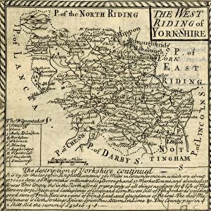
The West Riding of Yorkshire by Robert Morden, 1695

![]()
Wall Art and Photo Gifts from Sheffield City Archives
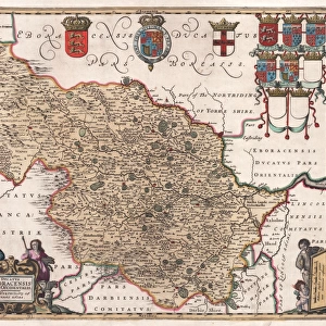
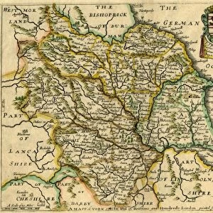
The West Riding of Yorkshire by Robert Morden, 1695
By Robert MordenScale 10 miles 2.5 inches.Original at Local Studies Library: E48S
Sheffield City Archives and Local Studies Library has an unrivalled collection of images of Sheffield, England
Media ID 14047500
© Sheffield City Council
FEATURES IN THESE COLLECTIONS
> Arts
> Artists
> M
> Robert Morden
> Europe
> United Kingdom
> England
> Yorkshire
> Sheffield
> Maps and Charts
> Related Images
> Sheffield City Archives
> Maps and Plans
> Maps of Yorkshire
EDITORS COMMENTS
This print showcases a historic gem, "The West Riding of Yorkshire" map by Robert Morden from 1695. A true testament to the artistry and precision of cartography during that era, this masterpiece offers a glimpse into the rich history of Yorkshire's West Riding. With its scale meticulously set at 10 miles per 2.5 inches, Morden's map provides an intricate representation of the region's sprawling landscapes and charming towns. From Sheffield to Bradford, Huddersfield to Wakefield, every detail is carefully etched onto this remarkable piece. Preserved in Sheffield City Archives' Local Studies Library under reference E48S, this print serves as both a visual delight and an invaluable historical resource for researchers and enthusiasts alike. Its presence transports us back in time, allowing us to explore the very fabric of life in 17th-century Yorkshire. As we gaze upon this beautifully preserved artifact, we are reminded not only of its aesthetic appeal but also its significance as a cultural document. It unveils how our ancestors navigated these lands centuries ago and highlights their deep connection with nature and geography. Let this photograph be a window into the past – an invitation to delve into the stories held within each contour line and place name on Morden's masterful creation. May it inspire curiosity about our roots while igniting appreciation for the craftsmanship that has shaped our understanding of the world around us throughout history.
MADE IN THE USA
Safe Shipping with 30 Day Money Back Guarantee
FREE PERSONALISATION*
We are proud to offer a range of customisation features including Personalised Captions, Color Filters and Picture Zoom Tools
SECURE PAYMENTS
We happily accept a wide range of payment options so you can pay for the things you need in the way that is most convenient for you
* Options may vary by product and licensing agreement. Zoomed Pictures can be adjusted in the Cart.
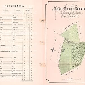
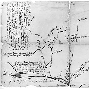

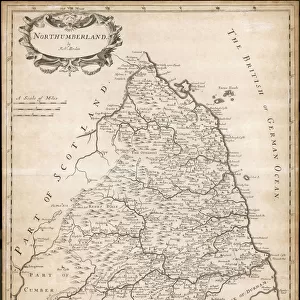
![A map of the lands at and near Crooks [Crookes] part in Ecclesall and part in Nether Hallam, 1790](/sq/716/map-lands-near-crooks-crookes-ecclesall-nether-14049486.jpg.webp)