Home > Maps and Charts > Related Images
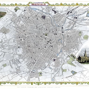
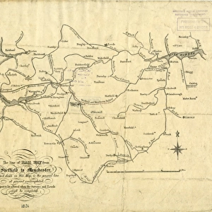
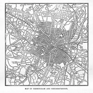
Plan of Sheffield c. 1880

![]()
Wall Art and Photo Gifts from Sheffield City Archives
Plan of Sheffield c. 1880
Original at Sheffield Local Studies Librarys 83 M
Sheffield City Archives and Local Studies Library has an unrivalled collection of images of Sheffield, England
Media ID 14086414
© Sheffield City Council
FEATURES IN THESE COLLECTIONS
> Maps and Charts
> Related Images
> Sheffield City Archives
> Maps and Plans
Plan of Sheffield c. 1880 - A Glimpse into the Industrial Heartland
EDITORS COMMENTS
. This print takes us back in time to the bustling city of Sheffield during the late 19th century. The image showcases a meticulously detailed plan, originally housed at the Sheffield Local Studies Librarys (83 M), offering an intriguing glimpse into the city's rich history and urban development. Sheffield, renowned for its steel industry, was rapidly transforming into a thriving industrial hub during this period. This plan serves as a valuable historical artifact, illustrating how the cityscape evolved amidst rapid growth and technological advancements. The intricate details depicted on this map highlight various landmarks that shaped Sheffield's identity at that time. From sprawling factories and workshops to bustling markets and residential areas, it encapsulates both the commercial prowess and everyday life of its inhabitants. Beyond its architectural significance, this photograph also invites reflection on social dynamics prevalent in Victorian society. It prompts contemplation about working conditions endured by laborers who contributed to Sheffield's rise as an industrial powerhouse. Preserved within Sheffield City Archives, this remarkable print offers researchers and enthusiasts alike an opportunity to delve deeper into understanding how cities evolve over time. It reminds us of our collective heritage while igniting curiosity about those who came before us. As we gaze upon this snapshot from yesteryears, let us appreciate not only the craftsmanship behind such meticulous planning but also recognize how it captures a pivotal moment in Sheffield's past—a testament to resilience, innovation, and community spirit that
MADE IN THE USA
Safe Shipping with 30 Day Money Back Guarantee
FREE PERSONALISATION*
We are proud to offer a range of customisation features including Personalised Captions, Color Filters and Picture Zoom Tools
SECURE PAYMENTS
We happily accept a wide range of payment options so you can pay for the things you need in the way that is most convenient for you
* Options may vary by product and licensing agreement. Zoomed Pictures can be adjusted in the Cart.