Home > Maps and Charts > Related Images
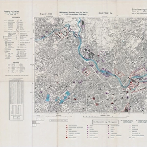
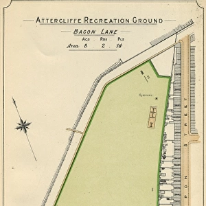
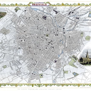
Sheffield Corporation Bill - land use density, 1900

![]()
Wall Art and Photo Gifts from Sheffield City Archives
Sheffield Corporation Bill - land use density, 1900
Scale 2 inches : 1 miles.Original at Sheffield Local Studies Library:s 95 L
Sheffield City Archives and Local Studies Library has an unrivalled collection of images of Sheffield, England
Media ID 14049956
© Sheffield City Council
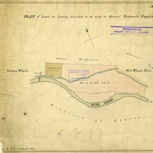
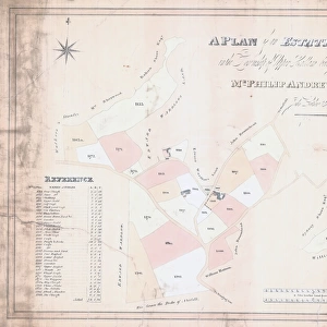
FEATURES IN THESE COLLECTIONS
> Maps and Charts
> Related Images
> Sheffield City Archives
> Maps and Plans
EDITORS COMMENTS
This print showcases the Sheffield Corporation Bill, a significant document that sheds light on land use density in the year 1900. The scale of this map is an impressive two inches to one mile, allowing us to delve into the intricate details of Sheffield's urban landscape during that era. Preserved at the esteemed Sheffield Local Studies Library under reference number s 95 L, this historical artifact offers a fascinating glimpse into the city's past. The photograph captures our attention with its rich and intricate cartography, revealing how land was utilized within Sheffield at the turn of the century. Streets and buildings are meticulously depicted, providing valuable insights into urban planning and development strategies employed by local authorities during this transformative period. While it is important to note that this image does not pertain to any commercial use or depict any specific company, it serves as a remarkable testament to Sheffield's growth and evolution over time. It invites us to reflect upon how cities have evolved since then while appreciating their historical roots. As we explore this print from Sheffield City Archives, we are reminded of our collective responsibility to preserve such invaluable records for future generations. This visual representation allows us to connect with our city's history in a tangible way - fostering appreciation for those who came before us and inspiring thoughtful discussions about shaping sustainable urban environments for years yet to come.
MADE IN THE USA
Safe Shipping with 30 Day Money Back Guarantee
FREE PERSONALISATION*
We are proud to offer a range of customisation features including Personalised Captions, Color Filters and Picture Zoom Tools
SECURE PAYMENTS
We happily accept a wide range of payment options so you can pay for the things you need in the way that is most convenient for you
* Options may vary by product and licensing agreement. Zoomed Pictures can be adjusted in the Cart.