Home > Arts > Artists > S > John Speed
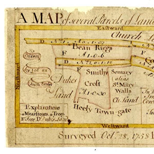
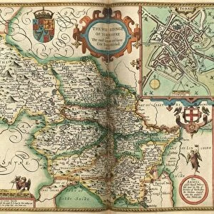
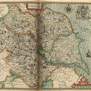
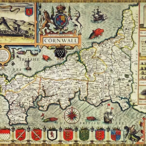
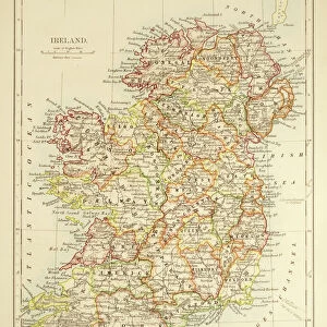
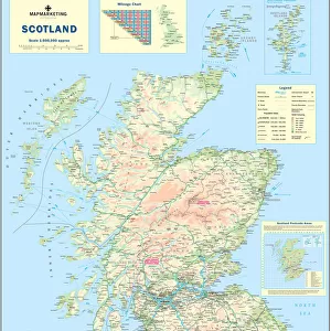
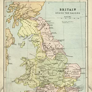
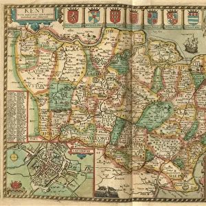
John Speeds map of Britain, 1611

![]()
Wall Art and Photo Gifts from Sheffield City Archives
John Speeds map of Britain, 1611
As it was divided in the time of the English Saxons...
Image from Theatre of the Empire of Great Britaine presenting an exact geography of the Kingdomes of Ireland, Scotland, Ireland, and the Iles adioyning with The Shires, Hundreds, Cities and Shire Towns, within ye Kingdome of England, divided and described by John Speed (original at Sheffield Libraries: 914.2 SQ).
Note this image is of a genuine 400-year-old map from a tightly bound volume. It shows some wear and tear as well as the binding in the middle of the image
Sheffield City Archives and Local Studies Library has an unrivalled collection of images of Sheffield, England
Media ID 26401732
© Sheffield City Council - All Rights Reserved
FEATURES IN THESE COLLECTIONS
> Arts
> Artists
> S
> John Speed
> Europe
> Republic of Ireland
> Maps
> Europe
> United Kingdom
> England
> Maps
> Europe
> United Kingdom
> England
> Sheffield
> Europe
> United Kingdom
> England
> Wells
> Europe
> United Kingdom
> Scotland
> Maps
> Sheffield City Archives
> Maps and Plans
> John Speed's County Maps, 1611
EDITORS COMMENTS
This print showcases John Speed's map of Britain from 1611, providing a fascinating glimpse into the historical division of the English Saxons. Extracted from Theatre of the Empire of Great Britaine, this image presents an accurate geography encompassing Ireland, Scotland, and the surrounding islands. The meticulous details within this map include not only the kingdoms but also the shires, hundreds, cities, and shire towns that constituted England during that era. As a genuine 400-year-old artifact sourced from Sheffield Libraries' archives (914.2 SQ), this print exhibits signs of its age with visible wear and tear. Additionally, due to its origin as part of a tightly bound volume, one can observe the binding in the middle section of this remarkable image. Immerse yourself in history as you explore every inch of this ancient cartographic masterpiece. Let your imagination transport you back to a time when borders were defined differently and kingdoms held their own unique identities. This photograph serves as both an educational tool for understanding past geographies and a testament to our enduring fascination with maps throughout centuries
MADE IN THE USA
Safe Shipping with 30 Day Money Back Guarantee
FREE PERSONALISATION*
We are proud to offer a range of customisation features including Personalised Captions, Color Filters and Picture Zoom Tools
SECURE PAYMENTS
We happily accept a wide range of payment options so you can pay for the things you need in the way that is most convenient for you
* Options may vary by product and licensing agreement. Zoomed Pictures can be adjusted in the Cart.