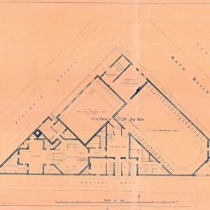
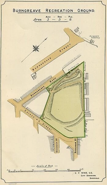
Plan of Burngreave Recreation Ground, 1897

Framed Print : Plan of Burngreave Recreation Ground, 1897
product preview 0
product preview 1
product preview 2
product preview 3
Size Guide
Close

Viewer Controls

  • Rotate: Left-click + drag
  • Pan: Right-click + drag
  • Zoom: Scroll wheel

Open 3D Preview


Prints
Poster Prints
Framed Prints
Cards
Canvas Prints
Mounted Prints
Jigsaw Puzzles
Fine Art Prints
Metal Prints
Home Decor

Framed Prints


Framed Print of Plan of Burngreave Recreation Ground, 1897

Image from Sheffield City Council, General Purposes and Parks Committee - Plans and Description of Parks and Recreation Grounds (Local Studies Library 352.7 SQ). Sheffield City Archives and Local Studies Library has an unrivalled collection of images of Sheffield, England. © Sheffield City Council

Your chosen combination is quickly and professionally made to order, our shipping page has more details

If you are not entirely happy with your items, simply return them to us within 30 days for a replacement or full refund. Please read our full returns policy.

Media ID 14047331


Bank Burngreave Ground Maps Road Street

Fast Delivery
Great Value
100% Payment Secure
30 Days Return

Modern 14"x12" (36x31cm)

Ready to Hang Contemporary Framed Prints adds style, protection, and a polished touch to your space - effortlessly.

Your artwork will be printed as shown in the preview. To adjust please select Edit Printed Image under the Buy button

Wood effect frame, card mounted, 10x8 fade resistant photo print. Overall outside dimensions 14x12 inches (36x31cm). Environmentally and ozone friendly, 40mm wide x 15mm Polycore® moulding has the look of real wood, is durable and light and easy to hang. Biodegradable and made with non-chlorinated gases (no toxic fumes) it is efficient; producing 100 tons of polystyrene can save 300 tons of trees! Prints are glazed with lightweight, shatterproof, optical clarity acrylic (providing the same general protection from the environment as glass). The back is stapled hardboard with a sawtooth hanger attached. Note: measurements provided are estimated outer dimensions, which include both the image and the frame. While we aim to keep sizing consistent, exact dimensions may vary slightly due to differences in print size or production requirements, which may result in a variation in the overall size (up to approximately 2.5cm (1"))

These are individually made so all sizes are approximate

Estimated Image Size (if not cropped) is 14.2cm x 24.4cm (5.6" x 9.6")

Estimated Product Size is 31cm x 36cm (12.2" x 14.2")


Features In These Collections

> Maps and Plans

You May Also Like


Gallery Wall Inspiration

The United States of North America with the British and Spanish territories, 1783
North perspective view of the town of Sheffield, c. 1737
A map of the land belonging to Wortley Forges, 1746
Plan showing the connexion of canals and navigable rivers by the proposed north-eastern Canal, 19th cent
Part of the United Provinces with the marches of the different divisions of the Prussian army in September 1787
Map of Joseph Machens Farm at Wadsley Bridge, Sheffield, 1790
Plan of Freehold Property situate in High Street belonging to William Younge, 1847
Plan of the Highfield Estate as laid out for Building Purposes, 1873
Roads at Lodge Moor Hospital: A plan showing carriageways and ash paths, early 20th cent
Plan of the Turkish, Swimming and other baths, Convent Walk, Sheffield; for sale, 1890
Map of the Vicarage Croft in Sheffield a, 1756
Plan of three lots of freehold property belonging to the administratrix of the late Samuel Cocker, 1850
Proposed street improvement between Commercial Street and Market Street
Plan of H I Dixon esquires Stumperlow Estate as proposed to be laid out for building purposes, 1886
A Map of Norwood Hall Estate in the Township of Brightside Bierlow and some adjoining Lands of the Duke of Norfolk, 1832
King Edward VII Crippled Childrens Institution, Rivelin Valley Road - block plan, 1913
Plan of part of the town of Sheffield comprising the site of the present and proposed Corn, Hay and Cattle Markets also various improvements connected with the latter, 1827
City of Sheffield Markets, 1924
Plan of freehold and leasehold property situate at Sharrow Head and Heeley to be sold by auction, 1851
Office floor plan of new Castle Market, Haymarket / Waingate, 1958
Gallery floor plan of new Castle Market, Haymarket / Waingate, 1958
Upper ground floor plan of new Castle Market, Haymarket / Waingate, 1958
Upper ground floor mezzanine plan of new Castle Market, Haymarket / Waingate, 1958
Lower ground floor mezzanine plan of new Castle Market, Haymarket / Waingate, 1958
City of Sheffield Central Planning Scheme, Historical Growth, 1938
Plan of Freehold Property in Sheffield known as Roscoe Works as advertised for Sale by Auction, 1888
Plan of freehold and leasehold property in the parish of Ecclesfield, 1869


© Copyright Sheffield City Council - All Rights Reserved 2026
Orders fulfilled by Media Storehouse®
We accept all major payment options so you can pay for the things you need in the way that is most convenient for you
Facebook     Flickr     YouTube     Instagram