Home > Europe > United Kingdom > England > London > Boroughs > Bromley
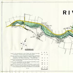
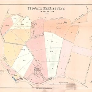
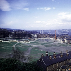
Plan of Crookesmoor Recreation Ground, 1897

![]()
Wall Art and Photo Gifts from Sheffield City Archives
Plan of Crookesmoor Recreation Ground, 1897
Image from Sheffield City Council, General Purposes and Parks Committee - Plans and Description of Parks and Recreation Grounds (Local Studies Library 352.7 SQ)
Sheffield City Archives and Local Studies Library has an unrivalled collection of images of Sheffield, England
Media ID 14047359
© Sheffield City Council
Crookes Facilities Football Gardens Ground Maps Park Parks Primary Road School Schools Sports Street Valley Albion Blythe Bromley Grounds Wentworth
FEATURES IN THESE COLLECTIONS
> Europe
> United Kingdom
> England
> London
> Boroughs
> Bromley
> Maps and Charts
> Related Images
> Sheffield City Archives
> Maps and Plans
> Sport
> Football
> Soccer
> Related Images
EDITORS COMMENTS
This print showcases the "Plan of Crookesmoor Recreation Ground, 1897" from the Sheffield City Council's General Purposes and Parks Committee. The image, sourced from the Sheffield City Archives, offers a glimpse into the past and provides valuable insights into urban planning during that era. The plan depicts a meticulously designed layout featuring various streets such as Oxford Street, Road Tay, Albion Street, and more. It also highlights key landmarks like Crookes Valley Park and Bromley Wentworth Martin Blythe Primary School. This comprehensive map not only serves as an important historical document but also sheds light on how public spaces were envisioned to cater to both sports enthusiasts and local communities. Crookesmoor Recreation Ground appears to be a hub for football grounds with dedicated facilities for different sports activities. The presence of numerous schools in close proximity suggests that this area was designed to provide ample recreational opportunities for young students as well. As we delve deeper into this remarkable photograph, it becomes evident that parks and gardens played an integral role in enhancing the quality of life in Sheffield at that time. This image is a testament to the city's commitment towards creating accessible green spaces for its residents' enjoyment
MADE IN THE USA
Safe Shipping with 30 Day Money Back Guarantee
FREE PERSONALISATION*
We are proud to offer a range of customisation features including Personalised Captions, Color Filters and Picture Zoom Tools
SECURE PAYMENTS
We happily accept a wide range of payment options so you can pay for the things you need in the way that is most convenient for you
* Options may vary by product and licensing agreement. Zoomed Pictures can be adjusted in the Cart.
![Plan of Freehold Estate at Crookes Moor [Crookesmoor] belonging to the executors of the late P Ashberry esquire, as laid out for building purposes, 1881](/sq/716/plan-freehold-estate-crookes-moor-crookesmoor-14049212.jpg.webp)
![A map of the lands at and near Crooks [Crookes] part in Ecclesall and part in Nether Hallam, 1790](/sq/716/map-lands-near-crooks-crookes-ecclesall-nether-14049486.jpg.webp)