Home > Arts > Artists > P > Francis Place
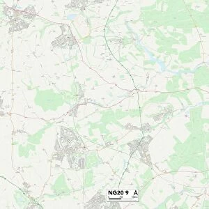
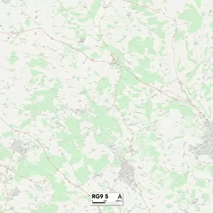
Barrow-in-Furness LA14 4 Map

![]()
Wall Art and Photo Gifts from Map Marketing
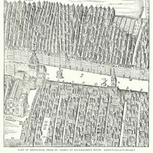
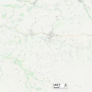
Barrow-in-Furness LA14 4 Map
Postcode Sector Map of Barrow-in-Furness LA14 4
Media ID 19972322
Abbey Road Abbey Way Baldwin Street Bank Lane Barrow In Furness Barrow Road Bradford Street Broad Close Chester Place Chester Street Cliffe Lane Cross Lane Dalton Lane Ennerdale Drive Greenhill Close Greystoke Gardens Grosvenor Street Harewood Close Hartland Road Hazel Close Hill Road Keswick Avenue Long Croft Middlefield Mill Bank Old Farm Close Park Road Patterdale Drive Portland Crescent Rydal Avenue The Crescent The Gardens Windermere Avenue High Cliff
FEATURES IN THESE COLLECTIONS
> Arts
> Artists
> P
> Francis Place
> Map Marketing
> Postcode Sector Maps
> LA - Lancaster
> Maps and Charts
> Related Images
MADE IN THE USA
Safe Shipping with 30 Day Money Back Guarantee
FREE PERSONALISATION*
We are proud to offer a range of customisation features including Personalised Captions, Color Filters and Picture Zoom Tools
SECURE PAYMENTS
We happily accept a wide range of payment options so you can pay for the things you need in the way that is most convenient for you
* Options may vary by product and licensing agreement. Zoomed Pictures can be adjusted in the Cart.