Home > Europe > United Kingdom > England > Yorkshire > Barnsley
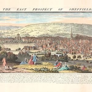
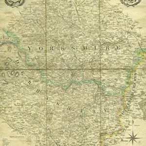
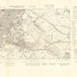
The West Riding of Yorkshire, 18th cent

![]()
Wall Art and Photo Gifts from Sheffield City Archives
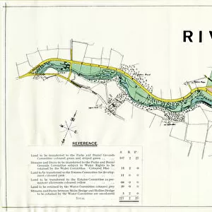
The West Riding of Yorkshire, 18th cent
Scale 15 miles 0.8 inches.
Original at Sheffield Libraries: y09455
Sheffield City Archives and Local Studies Library has an unrivalled collection of images of Sheffield, England
Media ID 14047642
© Sheffield City Council
Barnsley Doncaster Maps Rotherham Sheffield York Yorkshire Beverley Bradford Huddersfield Hull Leeds
FEATURES IN THESE COLLECTIONS
> Europe
> United Kingdom
> England
> Yorkshire
> Barnsley
> Europe
> United Kingdom
> England
> Yorkshire
> Bradford
> Europe
> United Kingdom
> England
> Yorkshire
> Doncaster
> Europe
> United Kingdom
> England
> Yorkshire
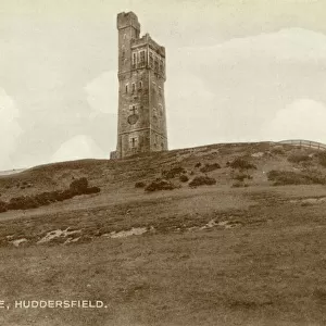
> Huddersfield
> Europe
> United Kingdom
> England
> Yorkshire
> Hull
> Europe
> United Kingdom
> England
> Yorkshire
> Leeds
> Europe
> United Kingdom
> England
> Yorkshire
> Rotherham
> Europe
> United Kingdom
> England
> Yorkshire
> Sheffield
> Maps and Charts
> Related Images
> Sheffield City Archives
> Maps and Plans
> Maps of Yorkshire
EDITORS COMMENTS
This print showcases "The West Riding of Yorkshire" during the 18th century, providing a fascinating glimpse into the region's rich history. The scale of 15 miles to 0.8 inches allows for intricate details to be captured, offering an immersive experience for viewers. Preserved at Sheffield Libraries and originating from Sheffield City Archives (y09455), this remarkable piece serves as a valuable resource for historians and enthusiasts alike. It highlights prominent cities such as Sheffield, Doncaster, Leeds, York, Barnsley, Rotherham, Bradford, Huddersfield, Hull, and Beverley that flourished in this era. The map offers more than just geographical information; it tells stories of bustling market towns with their vibrant trade routes and industrial centers that powered the region's growth. Each town is marked with precision on this print—roads connecting them like veins pulsating with life. As we delve into this visual time capsule meticulously preserved by Sheffield Libraries' dedicated team, we are transported back to an era where horse-drawn carriages traversed these roads amidst picturesque landscapes dotted with quaint villages. It is important to note that this print should not be used commercially but rather appreciated for its historical significance. Its presence reminds us of the importance of preserving our heritage through archives like Sheffield City Archives so future generations can continue exploring and learning from our past.
MADE IN THE USA
Safe Shipping with 30 Day Money Back Guarantee
FREE PERSONALISATION*
We are proud to offer a range of customisation features including Personalised Captions, Color Filters and Picture Zoom Tools
SECURE PAYMENTS
We happily accept a wide range of payment options so you can pay for the things you need in the way that is most convenient for you
* Options may vary by product and licensing agreement. Zoomed Pictures can be adjusted in the Cart.

![Plan of Freehold Estate at Crookes Moor [Crookesmoor] belonging to the executors of the late P Ashberry esquire, as laid out for building purposes, 1881](/sq/716/plan-freehold-estate-crookes-moor-crookesmoor-14049212.jpg.webp)
![A map of the lands at and near Crooks [Crookes] part in Ecclesall and part in Nether Hallam, 1790](/sq/716/map-lands-near-crooks-crookes-ecclesall-nether-14049486.jpg.webp)